Part 1: Kristen Puryear-Tidal Marsh Mapping in Maine: Status and Looking Ahead
Download presentation (PowerPoint)
The Maine Natural Areas Program (MNAP) has mapped over 22,000 acres of tidal marsh in Maine through a combination of desktop review and field survey. From ecological integrity assessments and restoration planning to marsh migration modeling and coastal carbon accounting, the data are being used across multiple planning and management actions. Kristen will discuss MNAP’s tidal marsh mapping methods and applications, and identify data gaps and future monitoring needs.
Part 2: Angie Brewer-Seagrass Mapping in Maine: Opportunities and Outcomes
Download presentation (PowerPoint)
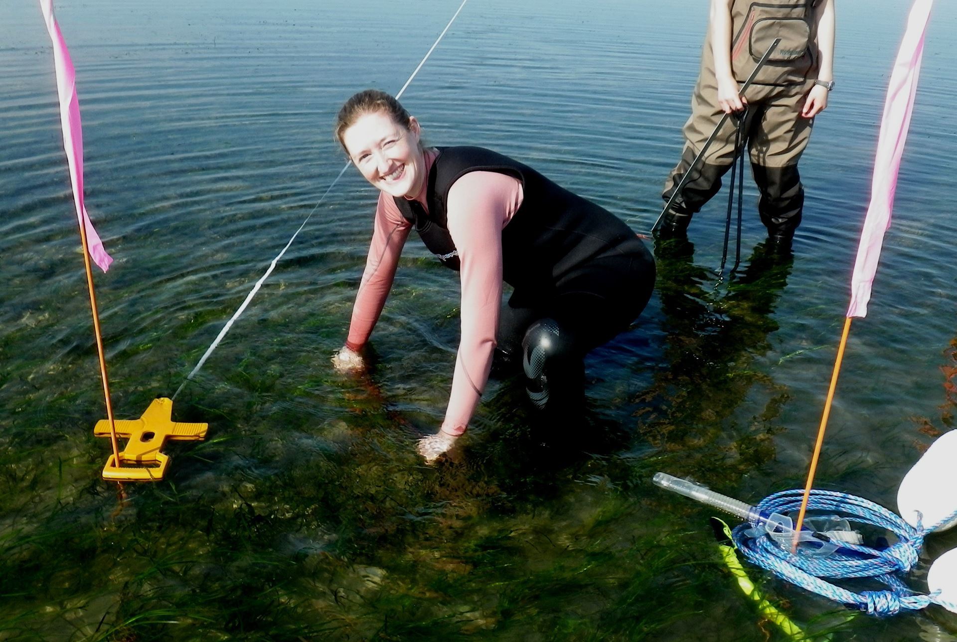
The Maine Department of Marine Resources (DMR) mapped intertidal and subtidal eelgrass along Maine’s coastline twice during the 1990s and 2000s using plane-acquired orthoimagery. Since 2013, the Maine Department of Environmental Protection (DEP) has continued efforts to inventory eelgrass on a more focused geographic scope, predominantly in Casco Bay. With the Maine legislature’s passing of LD 593 in 2021, DEP will manage coastwide mapping of seagrass and enhancements to existing salt marsh inventory, starting in 2023. Angie will outline the history and anticipated future of coastal seagrass and salt marsh mapping in Maine, identifying potential applications for new technologies and the myriad applications for data and GIS products, and solicit ideas for how to most optimally document and visualize vegetation change analyses for multiple users.
About the speakers:
Kristen Puryear is an Ecologist with the Maine Natural Areas Program, which is part of the Maine Department of Agriculture, Conservation and Forestry. For the last 15 years her primary responsibilities have included landscape analysis and field inventories, ecological monitoring, and working with land managers of private and public lands to identify priorities for conservation and management. Most recently her work has centered on the identification and field assessment of potential wetland mitigation sites, the integration of sea level rise and marsh migration into conservation planning efforts, and implementing saltmarsh condition assessments and long term monitoring. In 2020 she was a member of the Coastal and Marine Working Group for the Maine Climate Council, and Chair of the Ecosystem Conservation and Restoration Subcommittee, contributing to the Maine Climate Action Plan. 
Angie Brewer is a Biologist within the Division of Environmental Assessment of the Maine Department of Environmental Protection (DEP). Since 2010, she has led the Marine Unit and overseen monitoring in Maine’s estuarine and coastal waters to address status of water quality and sensitive biological indicators as they pertain to Clean Water Act regulations. Angie provides technical expertise to DEP wastewater licensing and land resource staff, conducts review of quality management documentation, and offers guidance to citizen science organizations involved with marine monitoring. A particular focus on intertidal and subtidal mapping for seagrass has allowed Angie to address the priority topic of eutrophication impacts in the coastal zone. Recently, she has served on the Coastal and Marine Working Group of the Maine Climate Council, and worked collaboratively on strategy development for coastal carbon accounting and coordinated monitoring of Maine’s marine environment.